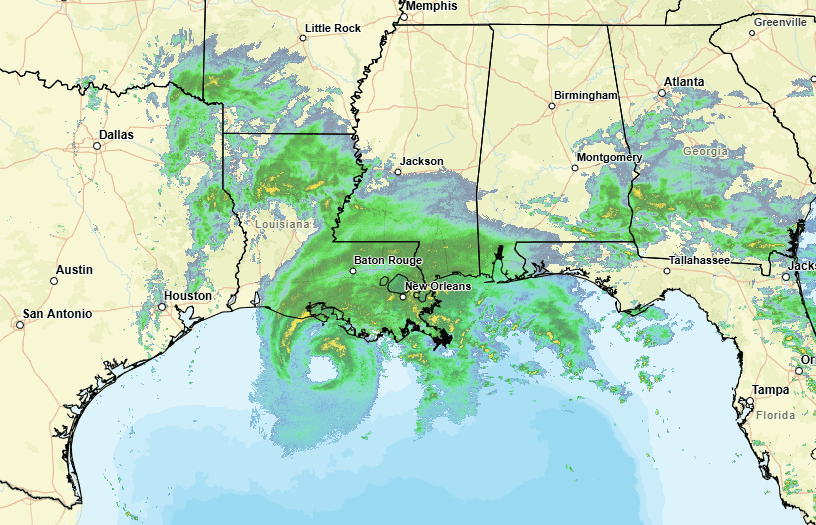
National Weather Service map, 1 pm CDT, Sept, 11, 2024
- Hurricane Francine is a strong Category 1 storm. Mississippians across the state will feel its impact. MEMA urges caution.
Hurricane Francine will make landfall along the Louisiana coastline by Wednesday evening.
As of the 1 P.M. advisory, Francine is moving northeast with maximum sustained winds of 90 mph, meaning it is a strong Category 1 storm.
The lower six counties along the Mississippi Coast remain under a Tropical Storm warning. The area is also under a Storm Surge warning, with surge estimated to range between 3-6 feet depending on the coastal Mississippi location.
In addition, the area is under a tornado watch until 11 P.M. as of now, given that Mississippi is on the east side, or the worst side, of the hurricane.
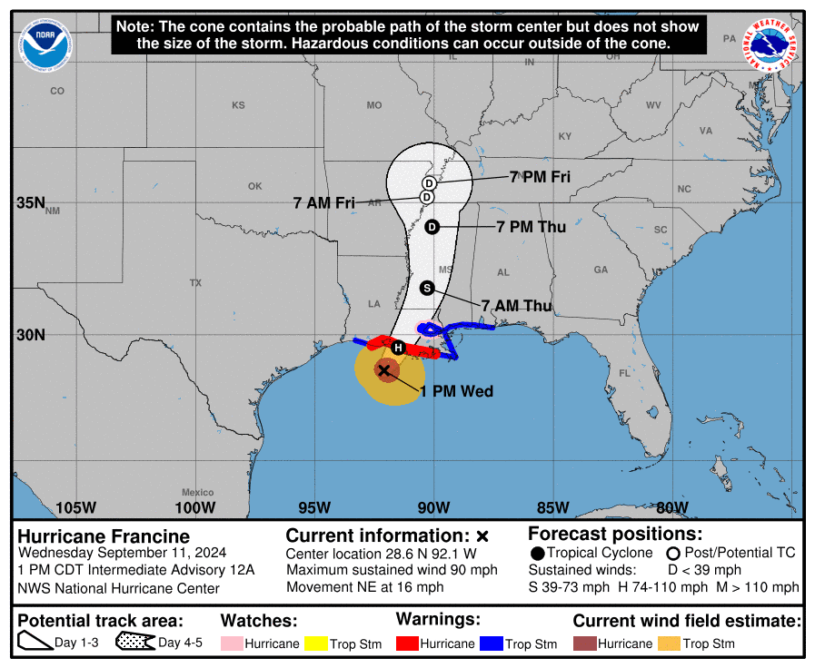
Wind gusts could exceed 60 mph across the Mississippi Coast over the next 12 hours.
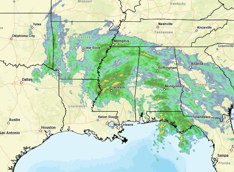
Francine is forecast to be well north of the Mississippi Coast by Thursday morning, maintaining Tropical Storm strength as it moves into Central Mississippi.
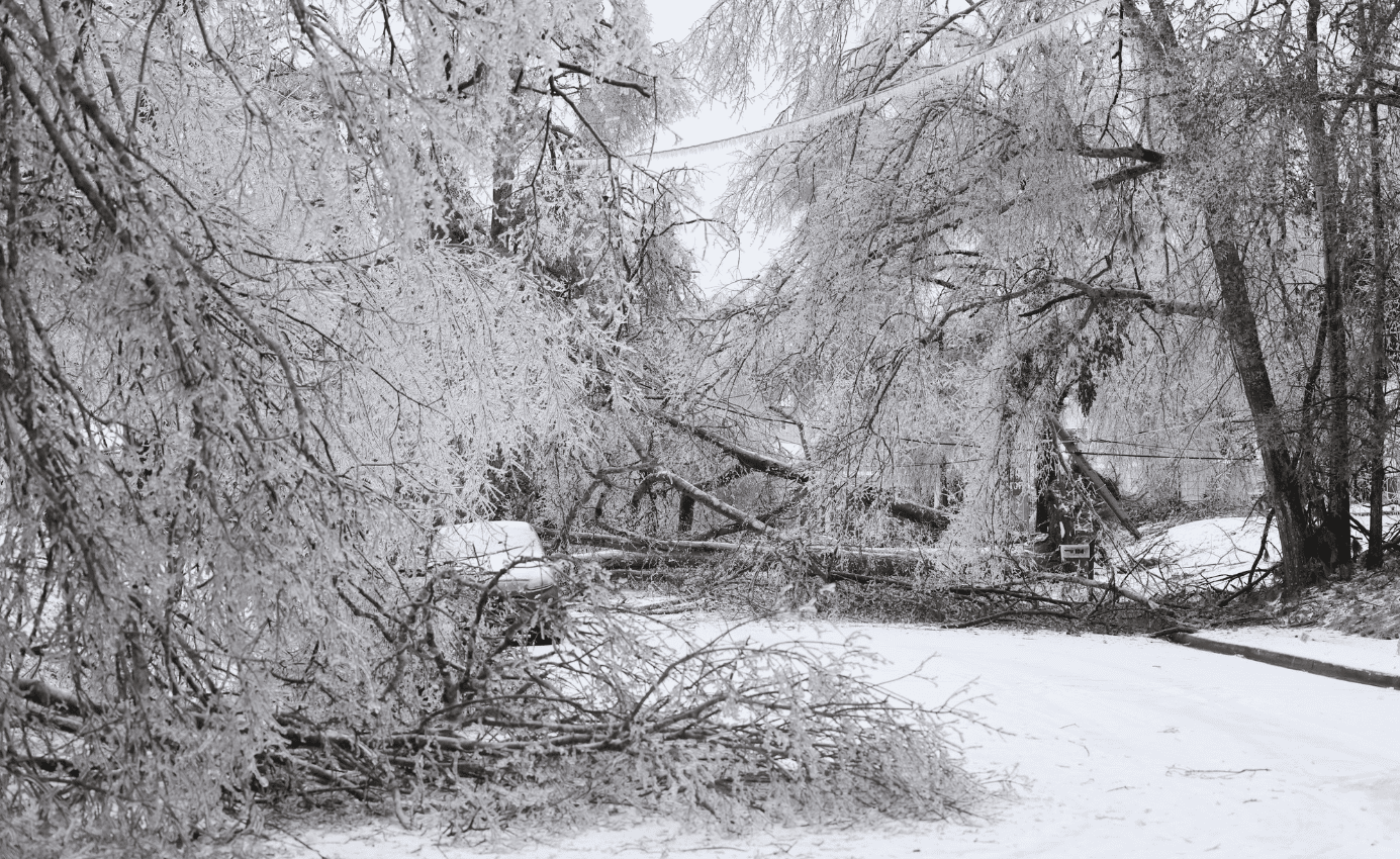
As the storm moves north through Mississippi, power outages and localized flooding from heavy rains are likely to occur across the state. Rainfall totals could push 4-8 inches in some areas.
Flood watches so far extend north into Tupelo ahead of Francine’s northward movement into Mississippi.
Local city and county governments have declared states of emergency as has Governor Tate Reeves for the state. This action allows government officials to mobilize assets and prepare to respond as the hurricane enters the state.
Many Coast businesses and most local school districts closed their doors Wednesday and are awaiting a decision as to whether to open Thursday, pending the impact on communities.
Emergency management officials urge Mississippians to stay weather aware and take precautions.

As The Weather Channel notes, “It’s been 30 years since the last time the Atlantic Basin went through the first full week of September without any active tropical cyclones, according to WPLG-TV hurricane expert Michael Lowry. And Colorado State University tropical scientist Phil Klotzbach noted the last time the Atlantic Basin went from Aug. 13 though Sept. 8 without any storms forming was in 1968.”

Frank Corder