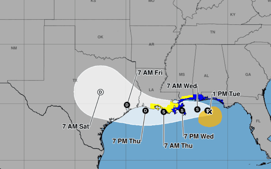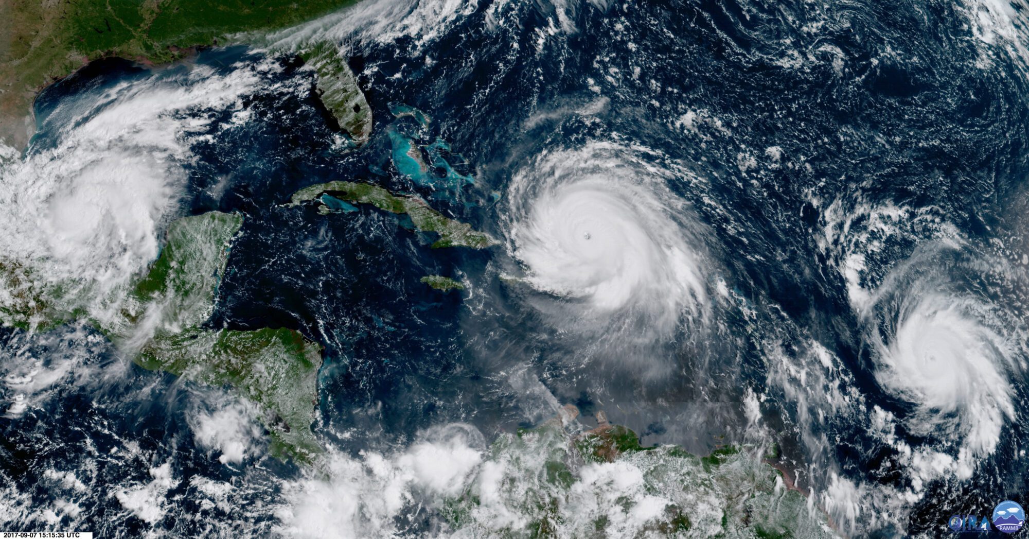
In this geocolor image GOES-16 satellite image taken Thursday, Sep. 7, 2017, at 11:15 a.m. EDT, shows the eye of Hurricane Irma, center, just north of the island of Hispaniola, with Hurricane Katia, left, in the Gulf of Mexico, and Hurricane Jose, right, in the Atlantic Ocean. Irma, a fearsome Category 5 storm, cut a path of devastation across the northern Caribbean, leaving at least 10 dead and thousands homeless after destroying buildings and uprooting trees on a track Thursday that could lead to a catastrophic strike on Florida. (NOAA via AP)
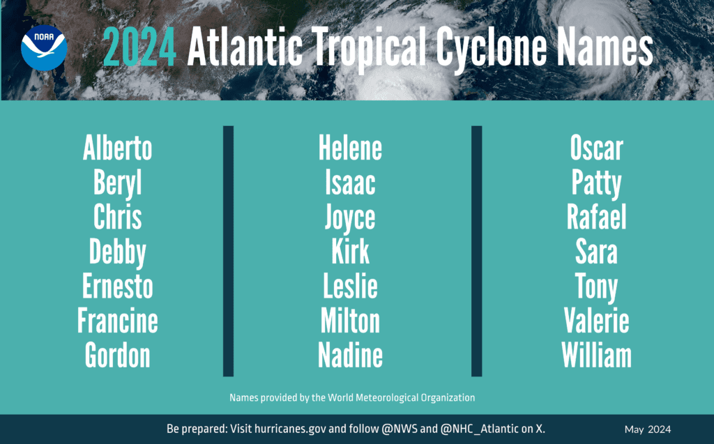
- Predictions estimate between 17 and 25 named storms this hurricane season, of which 8 to 13 could become hurricanes, with 4 to 7 developing into major storms.
The National Oceanic and Atmospheric Administration (NOAA) announced predictions for the 2024 hurricane season on Thursday, showing the possibility for the highest number of named storms ever for a May outlook.
The prediction is based off expected effects of La Nina in the Pacific, an African monsoon, and warmer average ocean temperatures.
Dr. Rick Spinrad, Administrator of NOAA, explained that their predictions estimate between 17 and 25 named storms this hurricane season, of which 8 to 13 could become hurricanes.
Storms receive names when their wind speeds reach 39 miles per hour and become hurricanes when wind speeds reach 74 miles per hour. Major hurricanes have winds speeds of 111 or more, ranking them a Category 3 or higher on the Saffir-Simpson Hurricane Wind Scale.
Spinrad added that four to seven major hurricanes are predicted to form this season.
“Of note, the forecast for named storms, hurricanes and major hurricanes is the highest NOAA has ever issued for the May outlook,” Spinrad explained.
According to NOAA, there is only a five percent chance that the upcoming Atlantic season, which starts in a week on June 1st and runs through November 30th, will be below normal. Yet, there is an 85 percent chance for an above normal season, leaving only a 10 percent chance of a normal season.
“This season is looking to be an extraordinary one in a number of ways based on our data and models with the El Nino and La Nina playing out in a significant role,” said Spinrad.
NOAA’s administrator said there is a 77 percent chance La Nina will occur, most likely during the months of August to October.
“We know the development of La Nina can lead to weaker easterly trade winds and below average vertical wind shear in the tropical Atlantic Ocean. This type of environment can be more conducive for tropical cyclone development,” Spinrad added.
The third factor in the prediction is from NOAA’s National Center for Environmental Information which foresees the formation of record warm water temperatures for most of the tropical oceans. Just like La Nina, those temperatures are expected to occur in August to October.
Matthew Rosencrans, Lead Hurricane Seasonal Forecaster, noted that the lack of shear expected due to La Nina and the African monsoon are important ingredients for storm development.
All of these conditions combined are called Accumulated Cyclone Energy (ACE).
“In past years when we have seen high ACE levels, those have historically been the years with the most destructive hurricanes. And this season NOAA is forecasting the second highest ACE for our outlook,” Spinrad.
The 2010 season holds the highest ACE so far, he said.
While the prediction is not favorable for a quiet hurricane season, officials are not calling for panic.
“It’s reason to be concerned of course, but not alarmed,” said Ken Graham, Director of the National Weather Service.
Graham advises those in the path of a storm not to focus too much on the wind speed, but be mindful of the water storms bring, especially heavy rainfall that leads to flooding. Most of the storm related deaths – 90 percent – that occurred between 2013 and 2023 were the result of water, most of which was fresh water. Graham added that half of those fresh water related deaths involved people trying to drive through flooded areas.
“So, turn around don’t drown,” Graham said.
In the last century, there has been a trend of major storms forming quickly, leaving little time to prepare after the storm becomes a major hurricane. Graham explained that every Category 5 storm that made landfall over the last 100 years was a tropical storm for less three days prior to its development.
“The big ones move fast,” Graham elaborated, noting that those storms had an average lead time of 50 hours.
To help make predictions and forecasts more accurate, new technology is being employed this year. Officials says those critical investments will allow NOAA to build out advanced water models, provide real time high-resolution flood inundation maps nationwide, and employ next generation radar.
“These investments are critical. We know communities can be devastated from the impacts of hurricanes,” Spinrad said.
Other investments include the launch of a new satellite that will provide NOAA with more atmospheric and oceanic data to forecast tropical activity. Hurricane hunter aircraft will continue their operations, a key station of which is found in Biloxi at Keesler Air Force Base, and there are plans to replace aging planes, Spinrad said.
This year, a new experimental cone of uncertainty will be employed. It will not only include the potential path of the eye of the storm but show possible impact areas outside of the eye. Graham said the new graphic will help those in the path better understand the impacts that typically occur outside the cone, such as wind and flooding from rainfall.
Americans living away from a coastline should also be mindful of hurricanes, since most deaths associated with storms take place inland.
In light of this prediction, FEMA Deputy Administrator Erik Hooks warns Americans to prepare early and remain diligent. Hooks advised that while planning a course of action consider if a necessary medication requires refrigeration, or if life-saving medical equipment needs electricity.
Preparing early can help families avoid long lines at grocery stores for food, water and other supplies while avoiding traffic congestion during necessary evacuations.